
TO READ THE HISTORY OF OUR NATIONAL HERITAGE AREA


Dena’ina villiages occupied the confluence of the Russian and Kenai Rivers. The trails that fisherman use today were the same trails that Alaska’s early people used to harvest salmon and prepare for the winter.
IMAGES:
- Dena’ina Family in 1901 near lower Cook Inlet (Simonson Collection; Anchorage Museum, B1991.009.142)
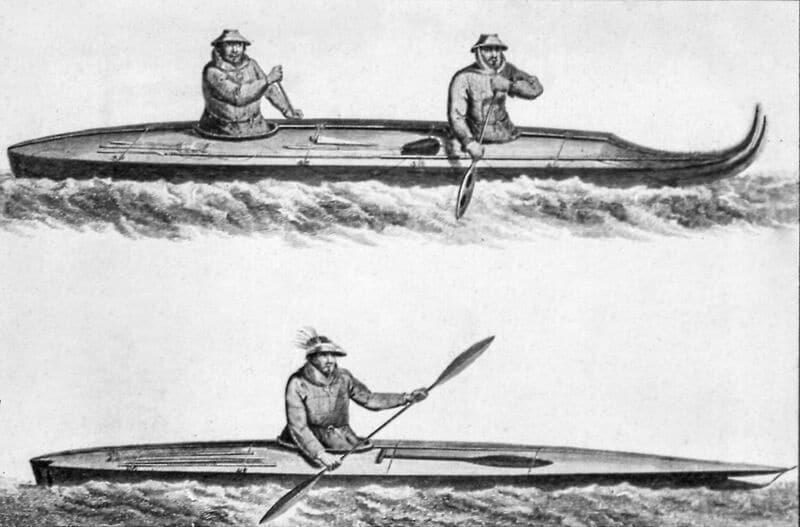
- Canoes of the Oonalashka (Courtesy of the Anchorage Museum)
- Woman of Prince William Sound, from the book “Charts and Plates to Cook” drawn by John Webber (Official artist on Cook’s 3rd Voyage) (Courtesy of the Anchorage Museum)
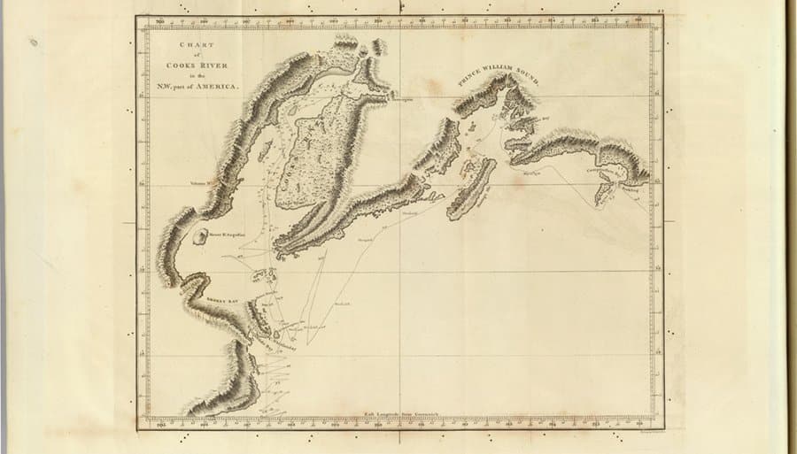
Captain James Cook reaches what is now known as Cook Inlet. Cook traced the outline of the Kenai Peninsula eventually sailing into a channel that he dubbed “River Turnagain”, which is now known as Turnagain Arm, due to the strong tides that required his boats to retreat.
IMAGE: Map of “Cook’s River” (David Rumsey Map Collection, www.DavidRumsey.com)

Russians arrived in Resurrection Bay. Alexander Baranov establishes Russian fur trade.
IMAGE: Port Okhotsk Engraving – Staging area for Russian expeditions into Alaska and a central trading center for eastern Russia. (Courtesy of the Anchorage Museum)
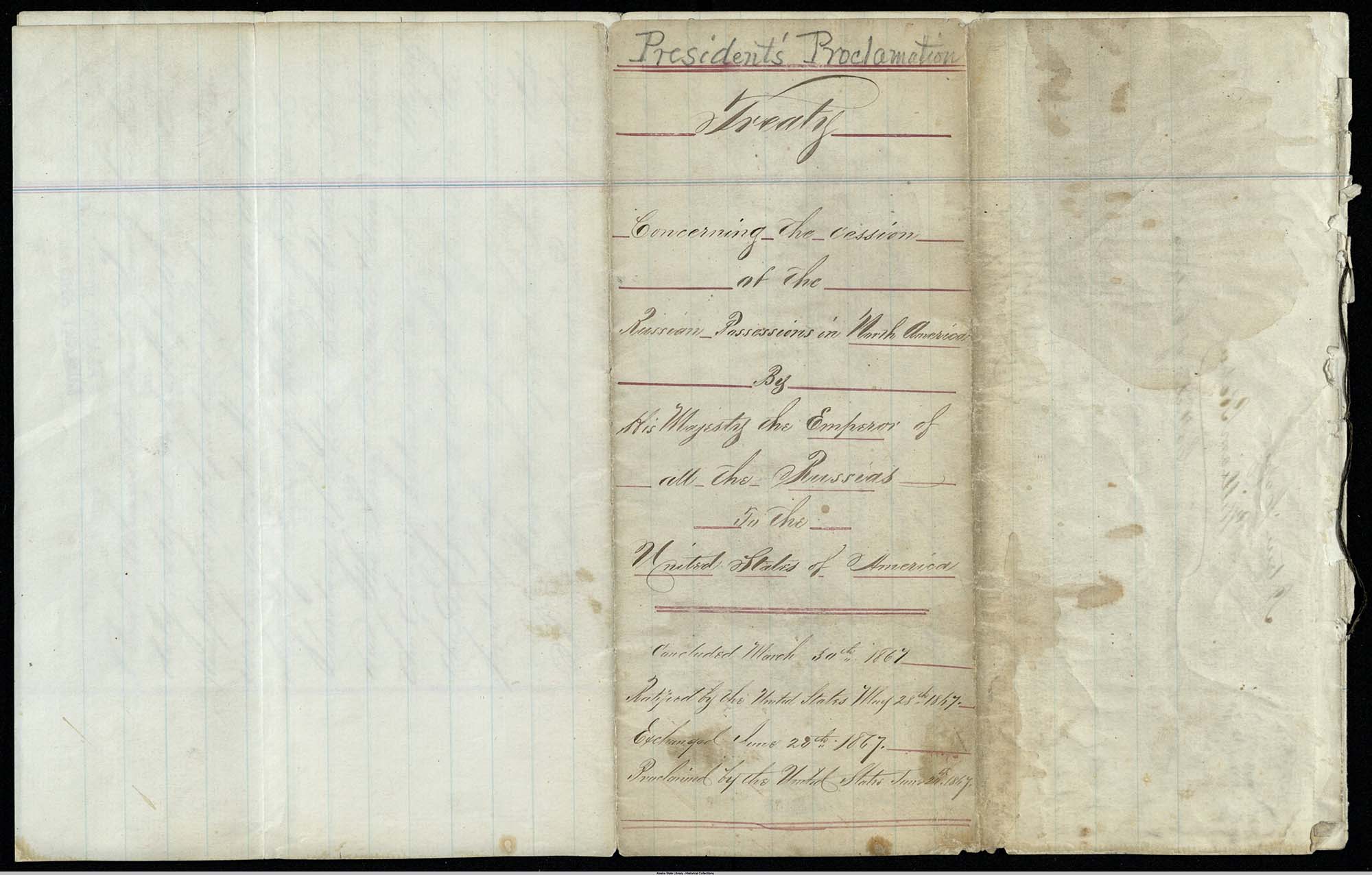


Purchase of Alaska from Russia. The United States, championed by Abraham Lincoln’s Secretary of State William H. Seward, paid Russia $7.2 million for the purchase of Alaska. Many scoffed at the purchase of an icebox and dubbed it Seward’s Folly.
IMAGES:
- President Andrew Johnson’s proclamation regarding the Alaska Treaty, (Courtesy of the Alaska State Library, ASL-E669-U52-clip)
- Signing of Treaty of Cessation 3/30/1867 (Courtesy of the Alaska State Library – Alaska Purchase Centennial Collection, P20-181)
- William H. Seward, Bureau of Engraving (Resurrection Bay Historical Society)
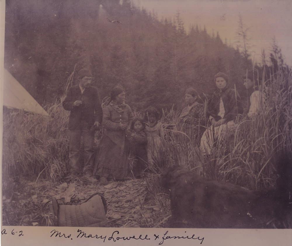
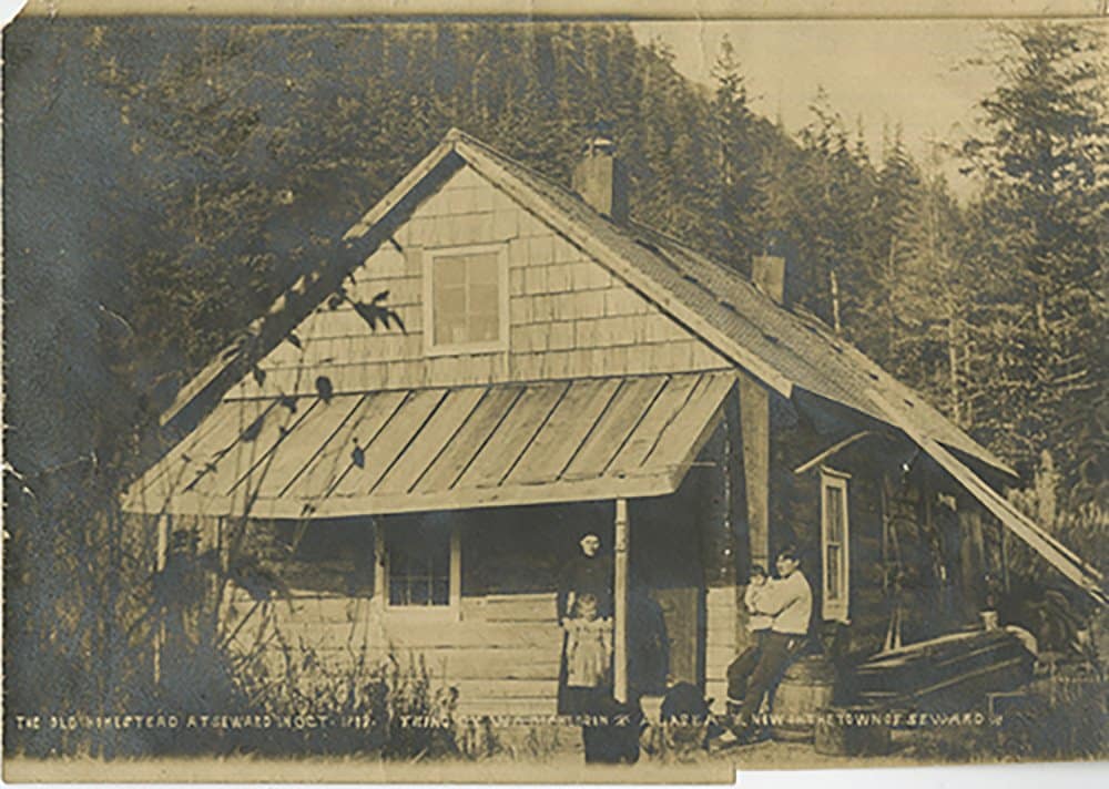
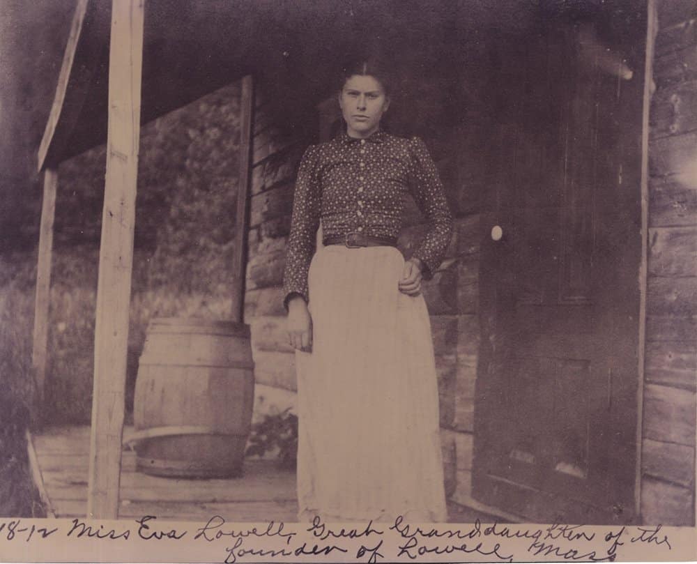
Mary and Frank Lowell sail into Resurrection Bay and settle the Seward area. Frank was not impressed, but Mary, who was pregnant and tired of travelling, refused to go on. Frank eventually left the family and moved to Port Wrangell. Mary remained with her nine children.
IMAGES:
- The Lowell Family – from left: William Lowell, wife Mary, two children, matriarch Mary Lowell, daughter Eva and possibly daughter Alice. (Resurrection Bay Historical Society 20.1.1.)
- 1903 view of the Lowell Homestead in what is now downtown Seward. (Resurrection Bay Historical Society 21.1.4)
- Eva Lowell (later Eva Revell, finally Eva Simons) in 1902 (Resurrection Bay Historical Society 20.2.1)
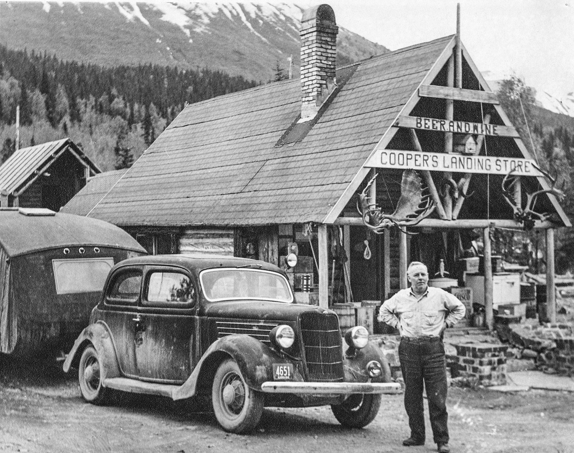
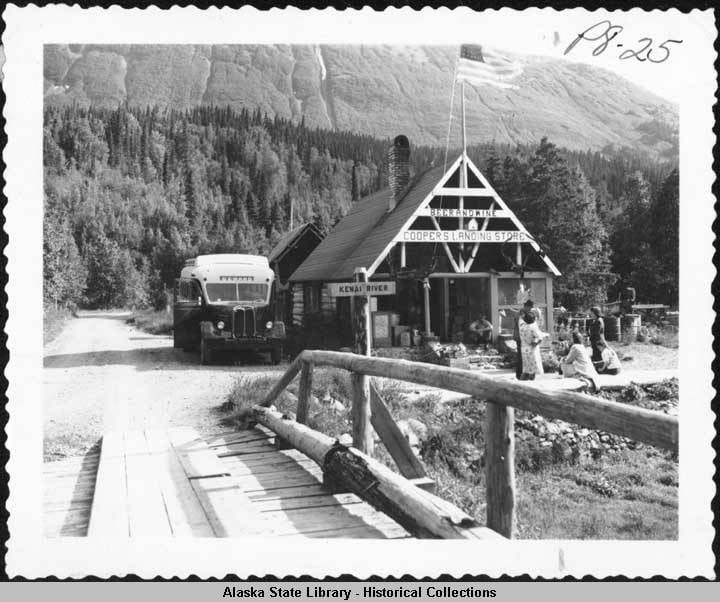

Joseph Cooper discovers gold in what is now known as Cooper Landing. Cooper Landing, Cooper Lake, and Cooper Creek are all named for him.
IMAGES:
- The Cooper Landing Post Office was established in 1937. Today the historic post office is located at the site of the Cooper Landing Museum at Milepost 48.7 of the Sterling Highway (Cooper Landing Historical Society)
- A bus bound for Seward is parked near the Cooper Landing Store. (Courtesy of Alaska State Library, Skinner Foundation. Photographs, Alaska Steamship Company, 1890s-1940s. ASL-PCA-44)
- The covered bridge at Schooner Bend, built in 1929, was the northernmost covered bridge in North America and spanned the Kenai River near Cooper Landing. It was was torn down in 1955. (Cooper Landing Historical Society)
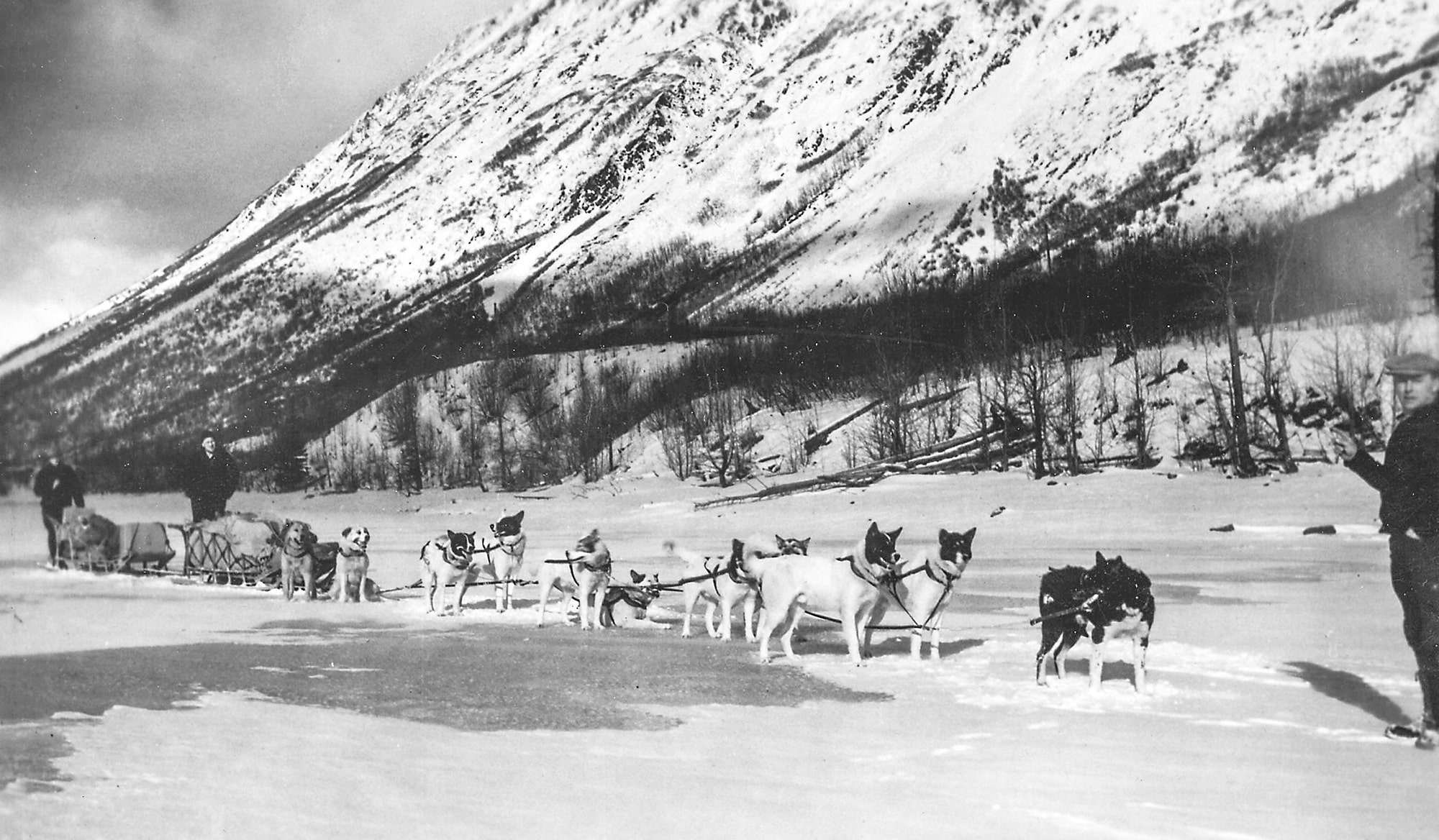
- Jack Lean, a Cooper Landing resident, delivered mail with his dog team known as the White Special. The cabin that Lean constructed eventually became the Cooper Landing post office. (Cooper Landing Historical Society)
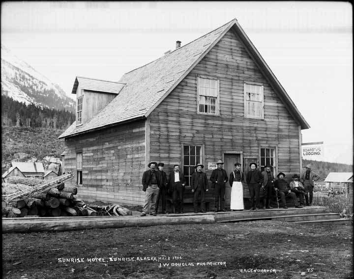

The mining community of Sunrise was established along the banks of Sixmile Creek as a result of the gold rush. For a brief time, Sunrise was the largest community in Alaska. All that remains is Point Comfort Cemetery.
IMAGES:
- Sunrise Hotel (Courtesy of the Alaska State Library, William S. Norton Collection, P226-478)
- Community of Sunrise (Courtesy of the Anchorage Museum, F.H. Moffit #196, U.S. Geological Survey, Denver, Colorado)
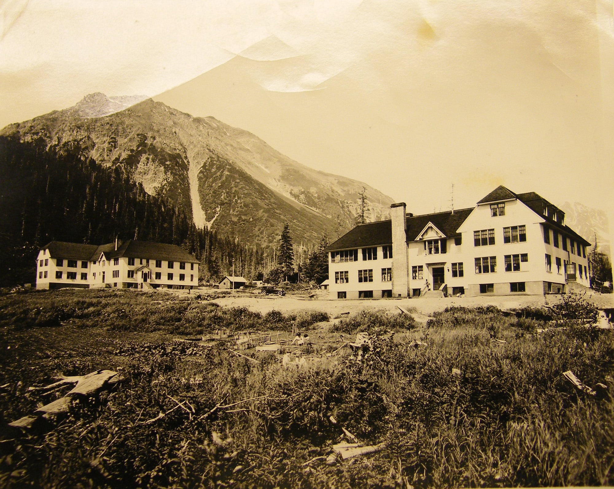
Hope, along with Sunrise, sprang up as a supply center for miners who stampeded to the area during the Turnagain Arm Gold Rush. Today Hope is considered the best preserved gold rush community in Southcentral Alaska. Many of the historical buildings are still in use.
IMAGES:
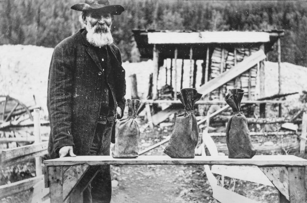
- Robert Mathison with 385 ounces of Gold, which was a result of 58 days of placer mining. Mathison and his family, originally from Texas, became one of the first families to settle permanently in Hope. (Hope and Sunrise Historical Society -Mathison Collection 2010.030.019)
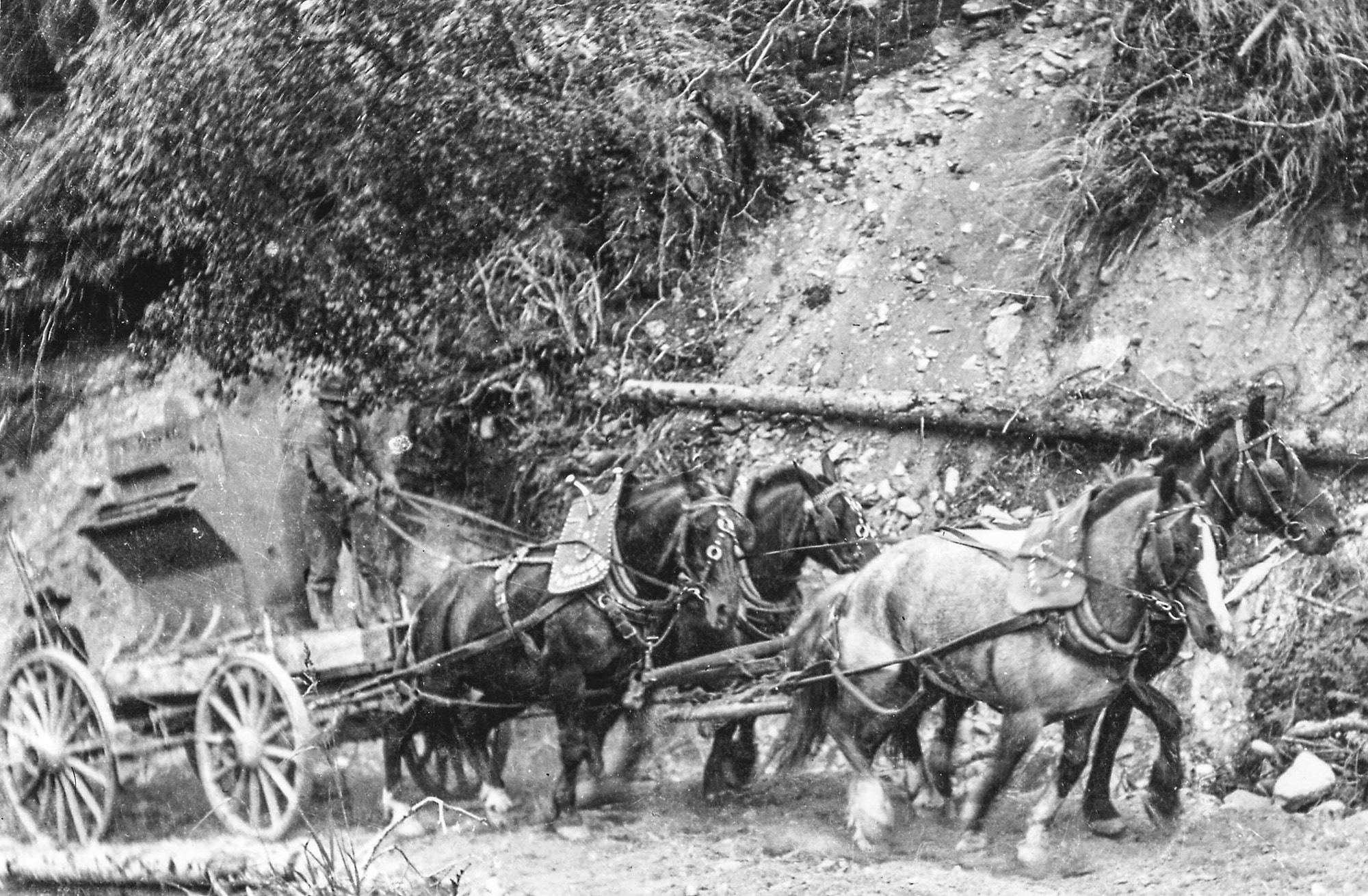
- A stamp mill, which was used to crush rock in search of gold, is transported on the back of horse-drawn wagon. Circa 1902 (Hope and Sunrise Historical Society – Carl Clark Collection 2010.029.044)
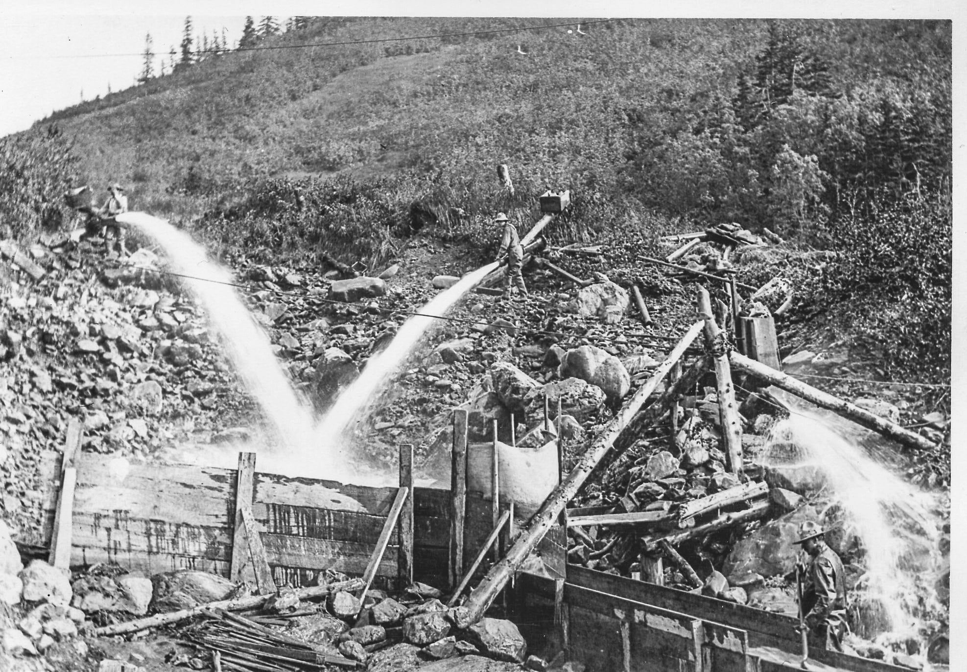
- After surface gold was mined by pick and shovel, miners used hydraulic methods to extract deeper placer gold. Water pressure from nearby creeks or man-made ditches pushed gold-bearing gravel through long lines of sluice boxes.(Hope and Sunrise Historical Society – Carl Clark Collection 2010.029.068)

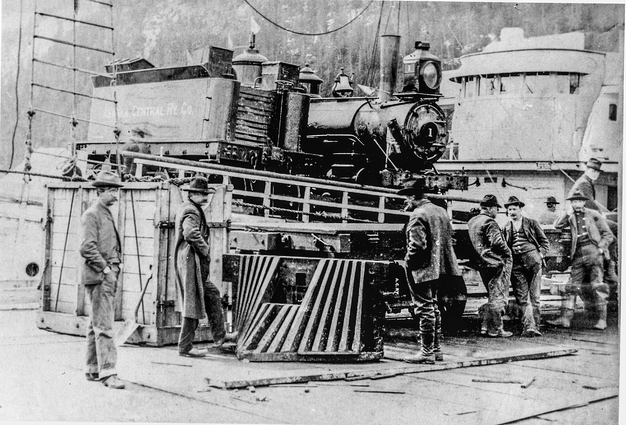
Alaska Central Railway construction begins. (It becomes the Alaska Railroad in 1915 when the U.S. Government takes over the project.)
IMAGES:
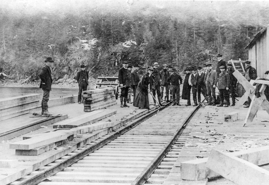
- Driving first spike on Seward Dock for Alaska Central Railroad, 1904 (Alaska Railroad Collection; Anchorage Museum, B1979.002.2503)
- The Loop, designed by Frank Bartlett, to bypass a glacier and steep grades through the Kenai Mountains. (Courtesy of the Anchorage Museum)
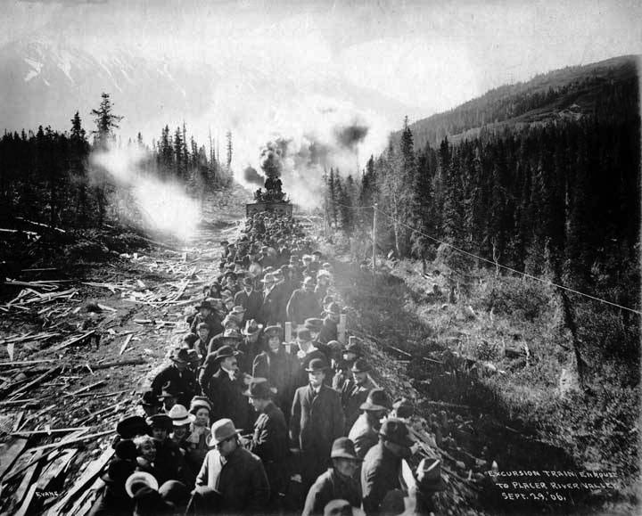
- Excursion Train enroute to Placer River Valley, 1906, (Courtesy of Alaska State Library, Feaster Family Collection, P349-040)
- Alaska Central Railway’s First Engine (Courtesy of the Anchorage Museum, Alaska Railroad Collection; Anchorage Museum, B1979.002.4813)
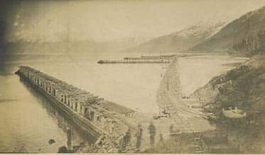
- Close-up view of Alaska Central Railway construction on Turnagain Arm. (Resurrection Bay Historical Society 701.1.40)
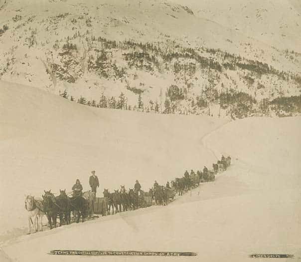
- Teams freighting supplies to construction camps on Alaska Central Railway. Case and Draper photo. (Resurrection Bay
Historical Society 701.1.70)
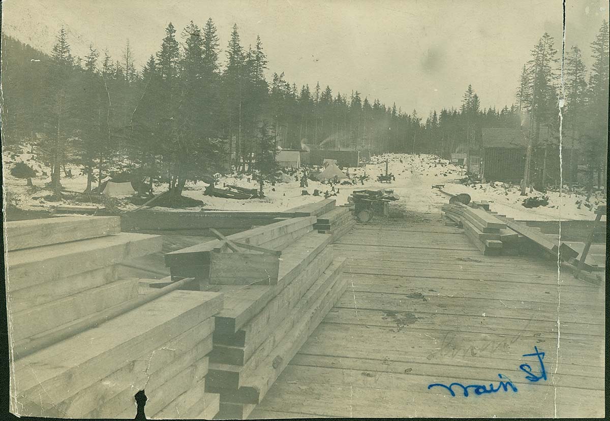
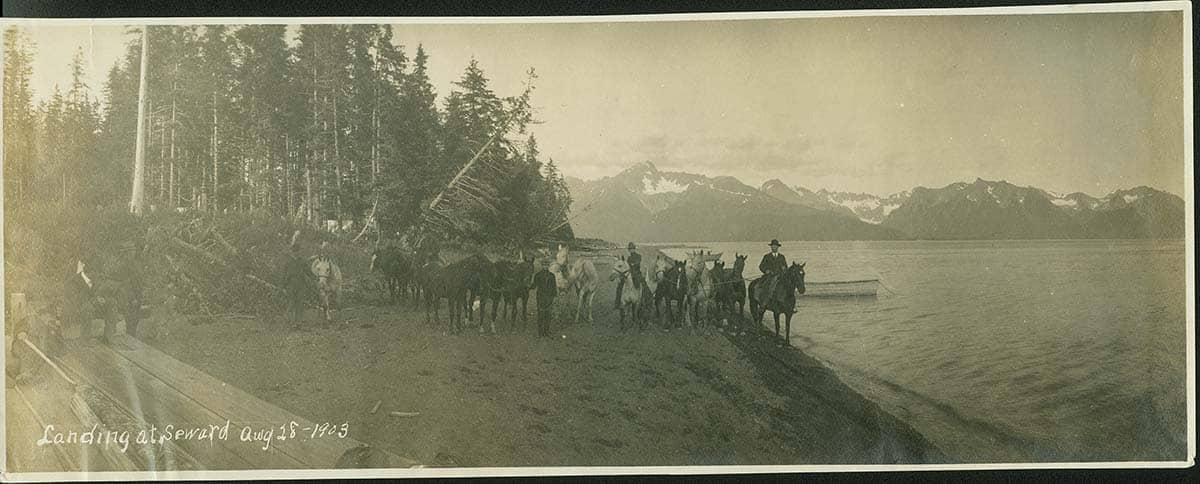
Official birthday of the city of Seward when John Ballaine and 82 other pioneers arrived in Resurrection Bay to build the railroad north.
IMAGES:
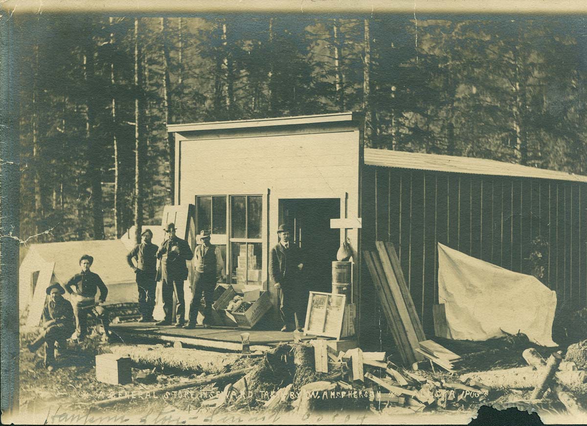
- T.W. Hawkins (in doorway) arrived Aug. 28, 1903, and started a store with Charles Brown. W.A. McPherson photo.
(Resurrection Bay Historical Society 506.1.5) - View looking north up Fourth Avenue from dock in 1903. (Resurrection Bay Historical Society 32.1.8)
- “Landing at Seward Aug. 28, 1903” shows people who arrived on the vessel Santa Ana. (Resurrection Bay Historical
Society 31.1.1)
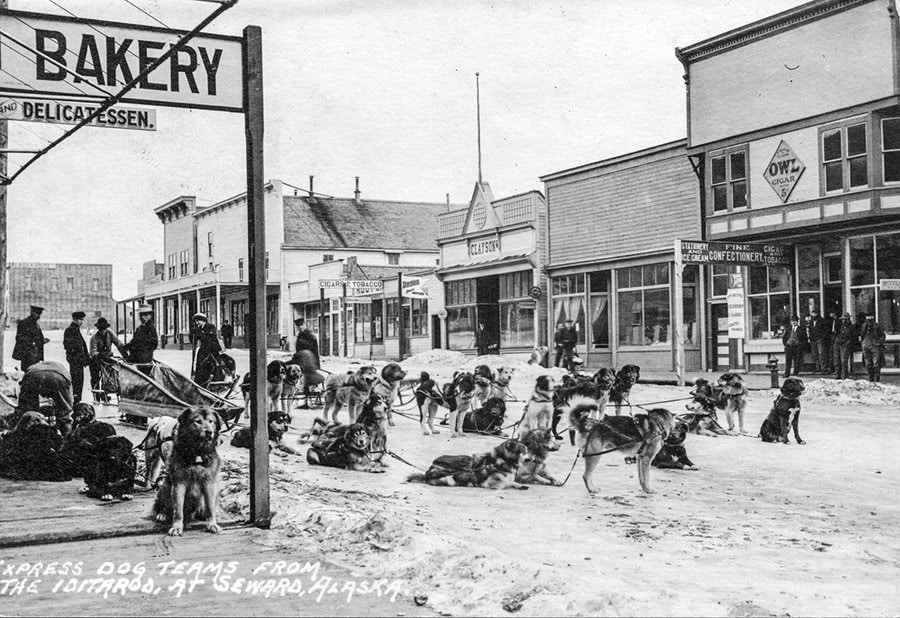
The Iditarod Trail system, originating in Seward, provided a winter dogsled route through the KMTA corridor to Alaska’s interior gold fields.
IMAGE: A Dog team stages in Seward (FIC Collection; Anchorage Museum, B1981.019.2)

The first Mt. Marathon foot race is held in Seward.
IMAGE: Johnny Hughes won first place in the 1939 Mt. Marathon Race. (Resurrection Bay Historical Society 78.1.65)
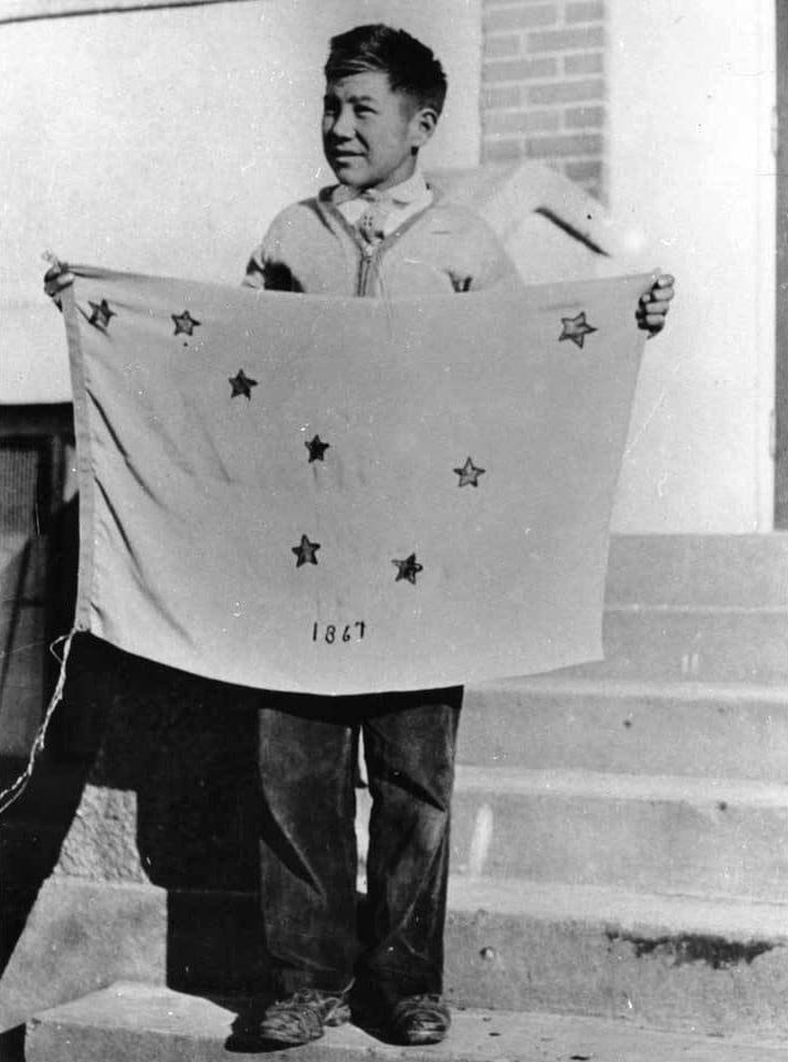
Benny Benson, a seventh grader who lived at the Jesse Lee Home for Children in Seward, won a contest for the design of Alaska’s territorial flag. The flag contains eight stars of gold on a field of blue, which represents the North Star and the constellation of the Big Dipper known as the Great Bear.
IMAGE:
- Benny Benson, Alaska State Library (Alaska State Library Portrait Collection, P01-1921)
- Benny Benson lived at the Jesse Lee Home, which was built in 1925 in Seward. (Resurrection Bay Historical Society
450.1.3)
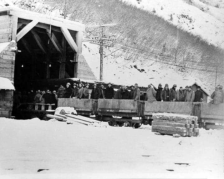
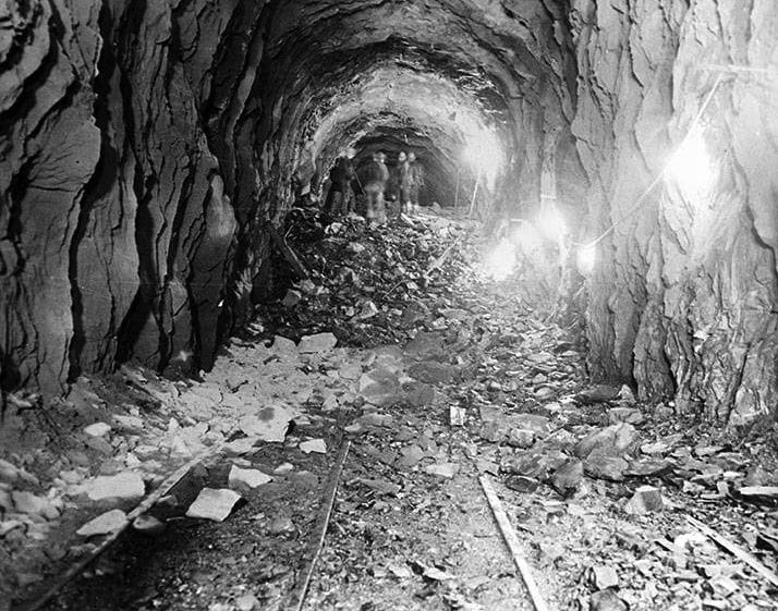
The Anton Anderson Memorial Tunnel, which connects Whittier to the Seward Highway, is completed. At two and half miles long, the tunnel is the longest combined highway and rail tunnel in North America.
IMAGES:
- View from the Bear Valley end of the Whittier Tunnel (Anton Anderson Memorial Tunnel) of a group of workers and others after the final blast in the construction of the tunnel. (Benjamin B. Talley papers, 1925-2002. Consortium Library, University of Alaska Anchorage UAA-HMC-0241)
- Passengers riding in open railroad cars enter the newly constructed Whittier Tunnel (Anton Anderson Memorial Tunnel) for the first time. (Benjamin B. Talley papers, 1925-2002. Consortium Library, University of Alaska Anchorage UAA-HMC-0241)
- A group of men stands on top a pile of rubble during the construction of the Whittier Tunnel (Anton Anderson Memorial Tunnel). (Benjamin B. Talley papers, 1925-2002. Consortium Library, University of Alaska Anchorage.UAA-HMC-0241)
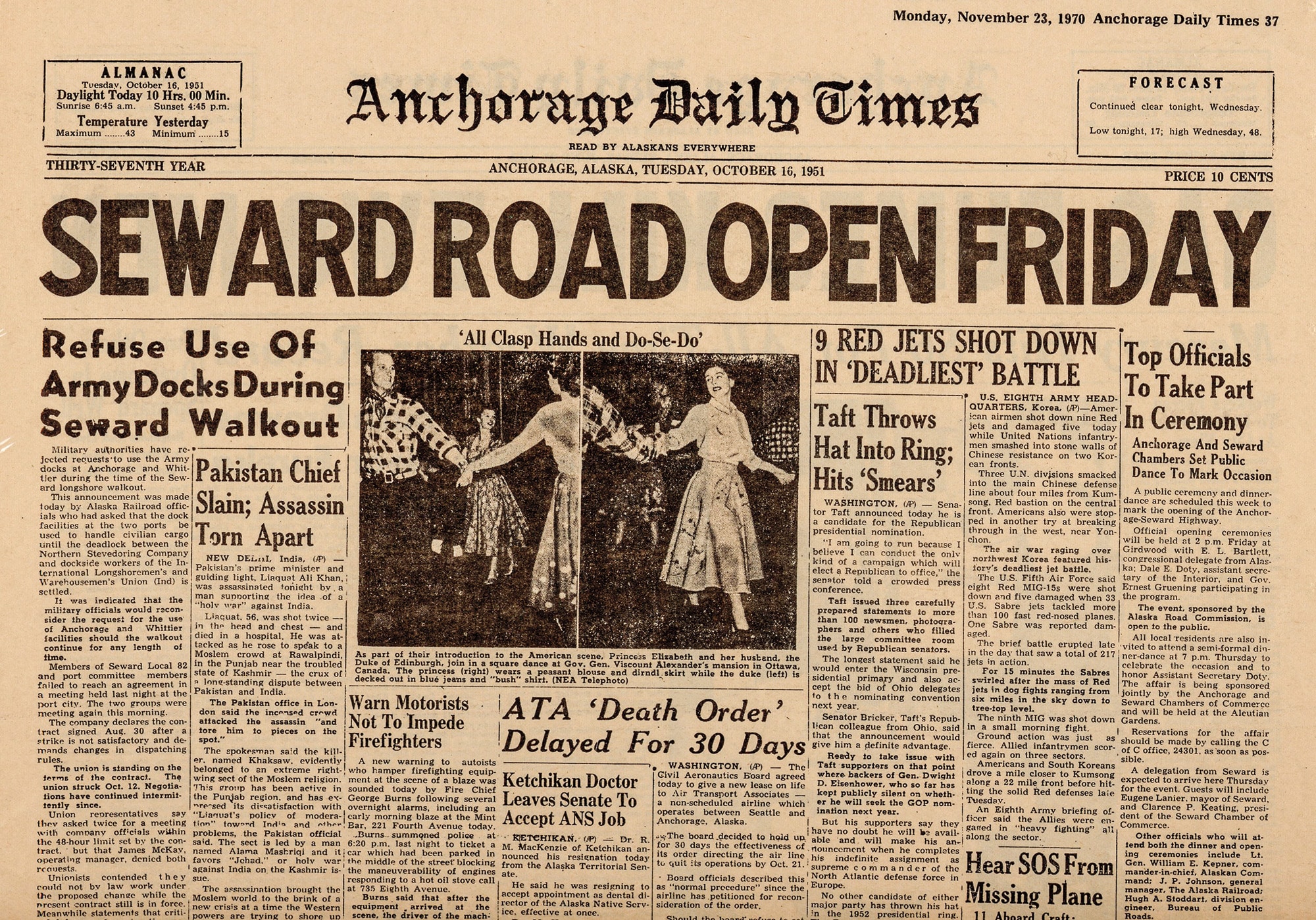
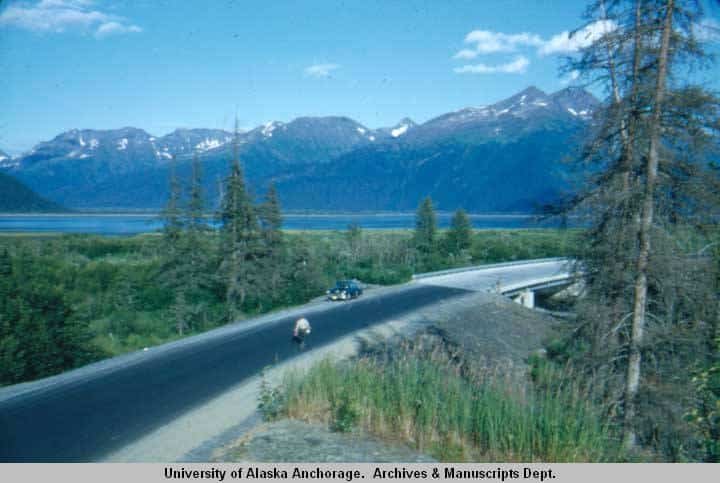
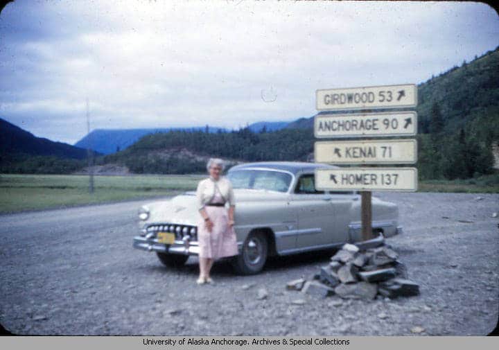
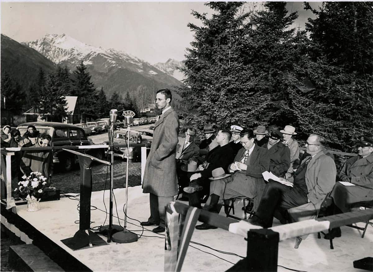
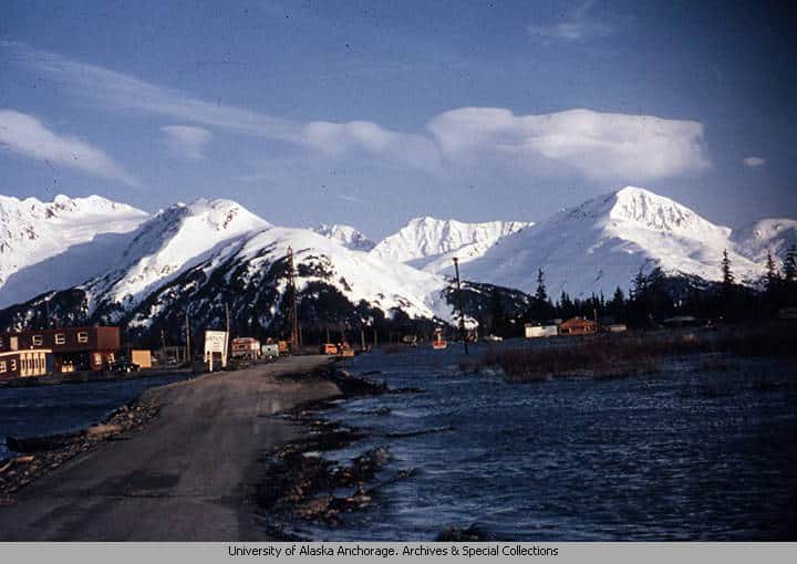
Seward Highway is completed.
IMAGES:
- The Anchorage Daily Times October 16th, 1951 front cover announces the opening of the Seward Highway (Cooper Landing Historical Society)
- Seward Highway view of the Chugach Mountains and Turnagain Arm on August 9th, 1952 (William O. L. Chinn photographs, 1951-1973. Consortium Library, University of Alaska Anchorage. UAA-HMC-0620)
- A woman stands next to a sign at the “Y” junction of the Seward and Sterling Highway. (Harry and Norma Hoyt family papers, 1908-1989. Consortium Library, University of Alaska Anchorage.UAA-HMC-0988)
- Dedication ceremony in Girdwood honoring the completion of the Seward Highway on October 19, 1951, with Baird M.
French, civil engineer in charge of construction of the highway, at the microphone. (Resurrection Bay Historical Society
901.3.1)
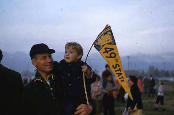
Alaska is proclaimed the 49th state of the Union.
IMAGE: Child holding “49th State” Pennant(UAA Consortium Library – Ruth A.M. Schmidt papers, 1912-2014, UAA-HMC-0792)
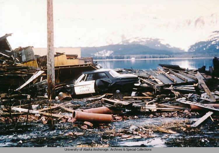
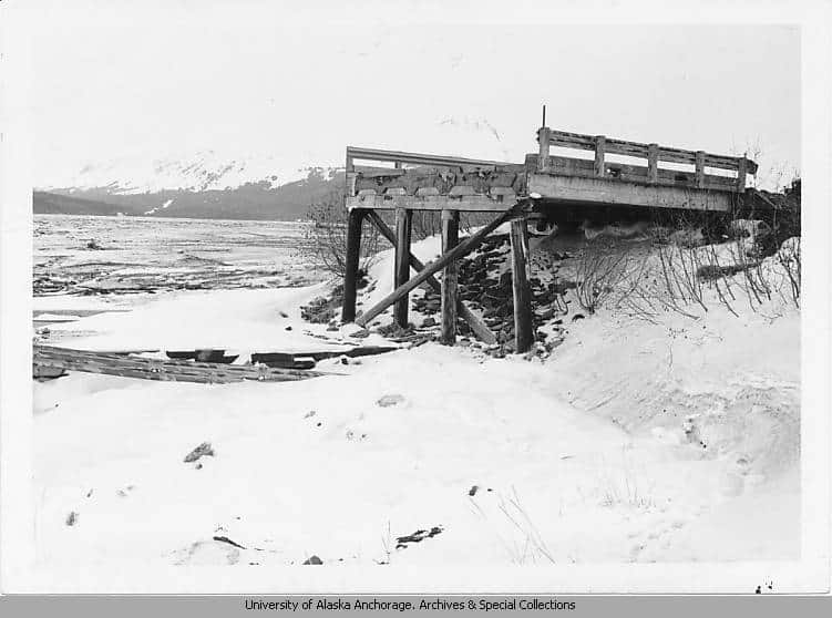

The Great Earthquake.
IMAGES:
- Town of Seward Alaska, taken on Easter Sunday 1964. Two days after the Alaska Earthquake.”
(Frank C. Fox photographs, 1946-1993. Consortium Library, University of Alaska Anchorage. UAA-HMC-0708 - View of a bridge along the Seward Highway which collapsed during the 1964 earthquake. (Robert Esterly photographs, 1964. Consortium Library, University of Alaska Anchorage. UAA-HMC-1264-AHS)
- View of damage in Portage, Alaska after the March 27, 1964 Great Alaska Earthquake.
(Kenneth J. Huseby photographs, 1964. Consortium Library, University of Alaska Anchorage. UAA-HMC-0427) - High Tide over the Seward Highway at Portage after the March 27, 1964 Great Alaskan Earthquake
(Stewart’s Photo Shop Collection, 1964-1992. Consortium Library, University of Alaska Anchorage.UAA-HMC-1181)
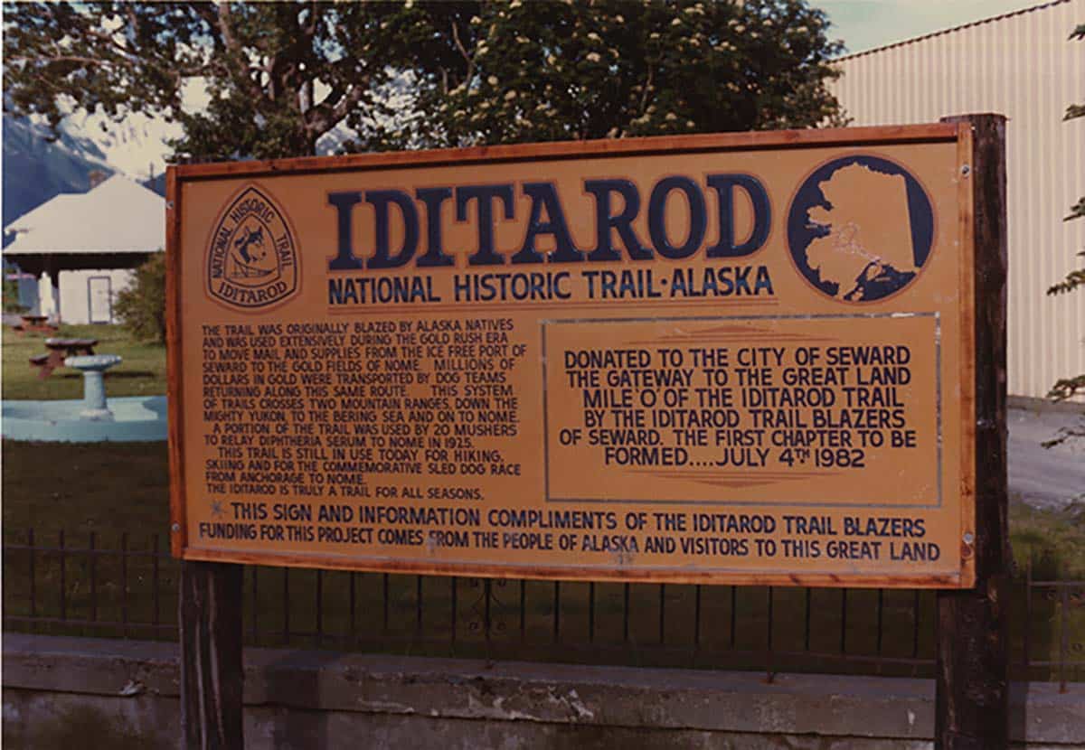
Congress designates the Iditarod Trail a National Historic Trail.
IMAGE: This sign designated the beginning of Iditarod Trail was erected in Seward in the 1980s. (Resurrection Bay Historical
Society 911.1.6)
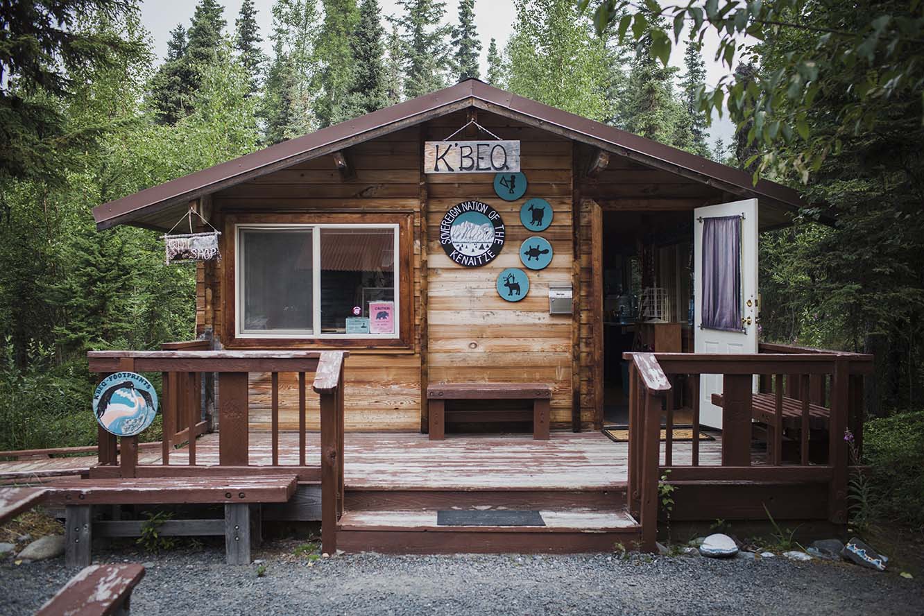
Archaeologists found prehistoric artifacts, Indian and Eskimo graves near Mile 55 of the Sterling Highway near Cooper Landing. The Kenaitze/USFS K’beq (Footprints) interpretive site opened near Mile 53 in 1997—-an earlier site opened in 1992 was closed.
KMTA National Heritage Area was established to recognize, preserve and interpret the historic resources and cultural landscapes of the Kenai Mountains- Turnagain Arm transportation corridor.
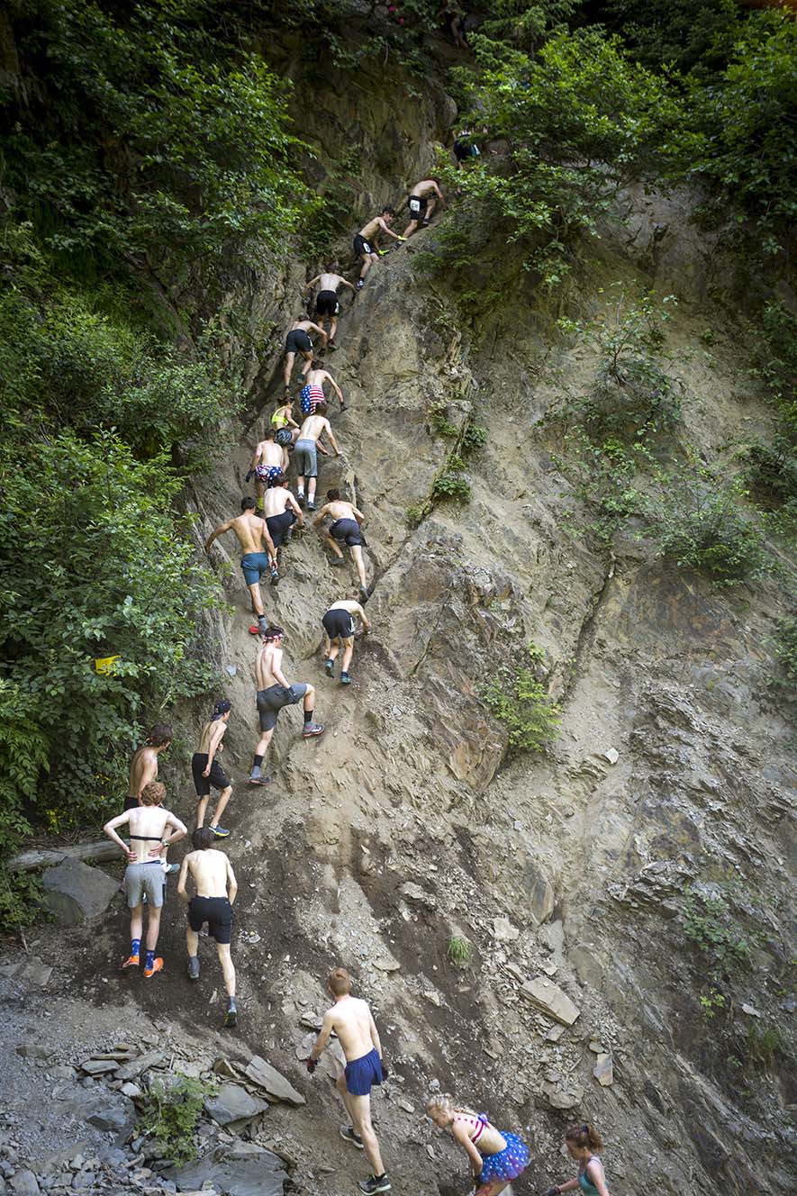
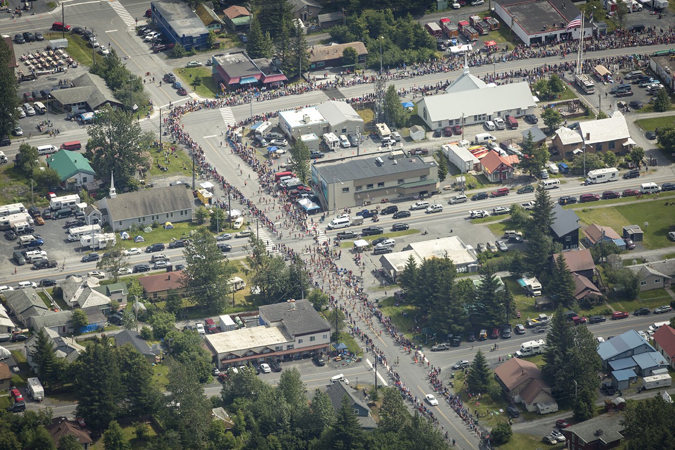
85th Running of Seward’s Mt. Marathon Foot Race.
IMAGES: All photos by Joel Krahn (Courtesy of the Seward Chamber of Commerce)
KMTA celebrates its 10th year as a National Heritage Area. In the past 10 years KMTA has invested over $1.07 million in local community projects, leveraging approximately $1.9 million through a multitude of volunteer, partner and community support.
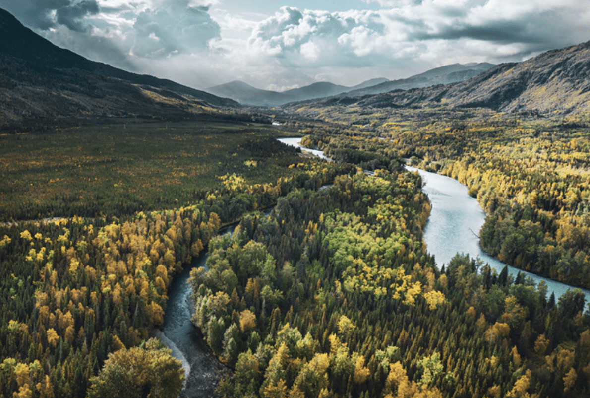
IMAGE: Confluence of the Russian and Kenai Rivers (Janessa Anderson)