By Shawn R. Lyons
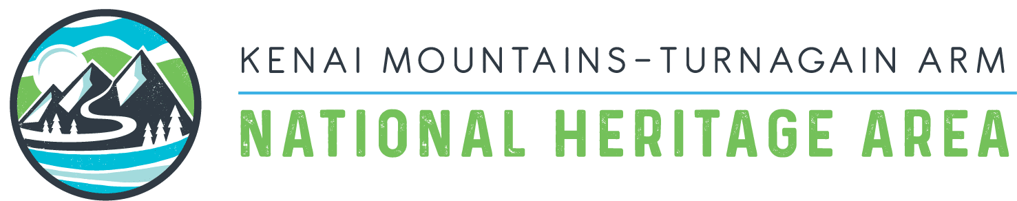
Looking back down Nissman Ridge to Turnagain Pass
As we started down the far side of the ridge toward Spencer Glacier, glistening in the afternoon sun some 7 miles distant and 3,000 feet below us, it seemed safe to say that few people had come this way before. A few skiers had crossed the very steep-sloped pass just above and behind us and a few of the hunting parties that supplied meat for the crews building the railroad up the Spencer Creek valley some 100 years had crossed one of the less dramatic passes to the west, but probably not many others.
Many skiers frequent Nissman Center Ridge, which we had started on that morning from the parking area in Turnagain Pass. But few hikers came this way in the summer. Art Copoulos and I came this way to find overland route to Whistlestop—an Alaska Railroad stop at the foot of Spencer Glacier. In the winter one could ski, snowmachine, or even hike the 8 miles from Seward Highway up the frozen Placer River valley to the glacier. But in the summer one could access the valley only by train or power boat.
We intended to establish summer access route for hikers. We thought it only would take about 9 or 10 miles of hiking from Seward Highway in Turnagain Pass to reach Whistlestop. We also intended to reach Whistlestop in time to take the 3 pm train back to Portage. After all, we thought, the only difficulty involved getting over the high ridge that separated the Lyon Creek drainage in Turnagain Pass from the Center Creek and Placer River drainages on the far side. Our thinking proved very wrong.
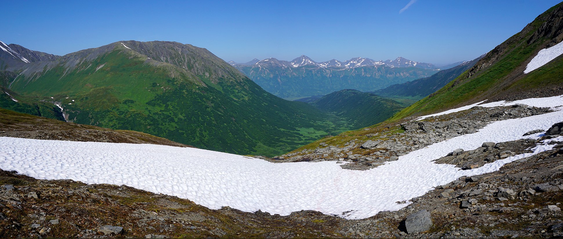
Hiking up Nissman Ridge
The first miles from Turnagain Pass proved quite easy and very scenic—especially once we rose above the brush and started southeast along the crest of Center Ridge. Before long the last brush fell away and we trudged through lush tundra surrounded by snow-smeared ridges and summits rising above us and broad-meadow valleys stretching away from us on either side. Ahead of us we could make out the headwaters of Lyon Creek where big snowfields still filled the cirques leading up to the back ridge.
After circling around the base of the buttress at the far end of Center Ridge we started up toward the nearest pass. Within another mile the tundra gave way to snow. The snow slowly steepened as we approached the last 200-foot climb up to the pass. Here we could plainly see a large cornice stretched across most of the narrow-notched pass.
“Well, let’s at least climb up to it and see if we can somehow squirm around it,” I suggested. And so we did-but it took a lot of grunting and slipping on the steep snow before we stood on a narrow ledge of exposed rocks right below the cornice. Then we tried one side, but found it too steep and unstable, the gravel and rocks kicking out from under each step.
Then we tried the other side. I managed to get 15 feet up alongside the cornice, but found the gravel only hid a core of ice-hard ground beneath it. Lunging for a hold, I missed and slipped back down, dropping with a thump back onto the ledge.
A second try, digging steps in the steep, hard slope with a stone soon allowed me to grab onto the wall of boulders at the crest of the pass. Art soon followed me up to the same spot.
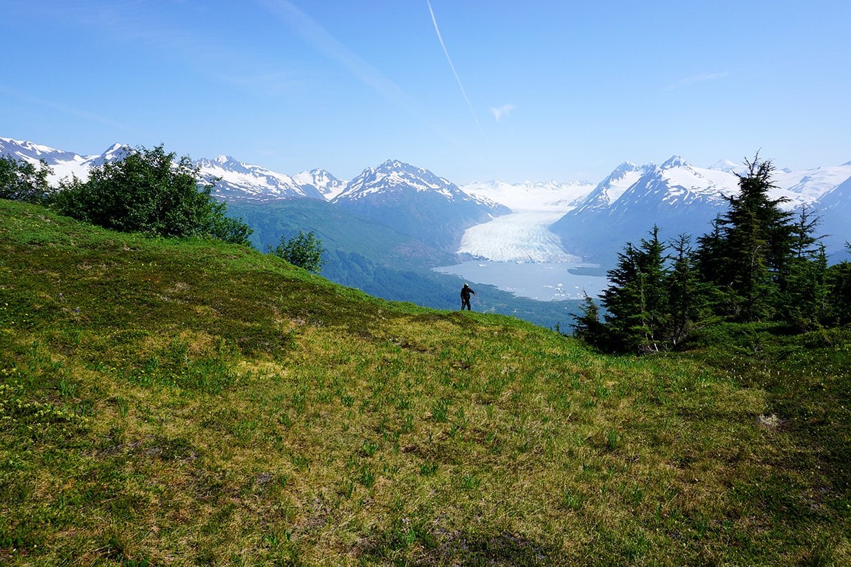
On the far side the slope dropped gently down to a snowfield which, in turn, dropped into the headwaters of Center Creek. Over the uppermost end of that valley we could see Spencer Glacier shining brilliantly.
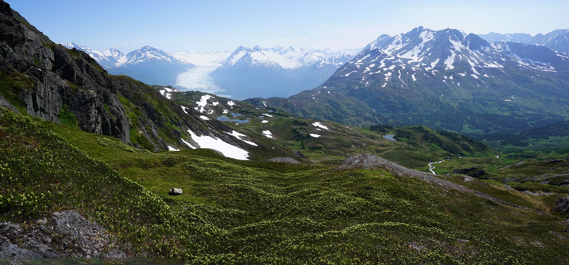
Looking across the Placer River Valley. Spencer Glacier can be seen in the top left.
As we stopped for a snack we expected easy going the rest of the way. We expected wrong.
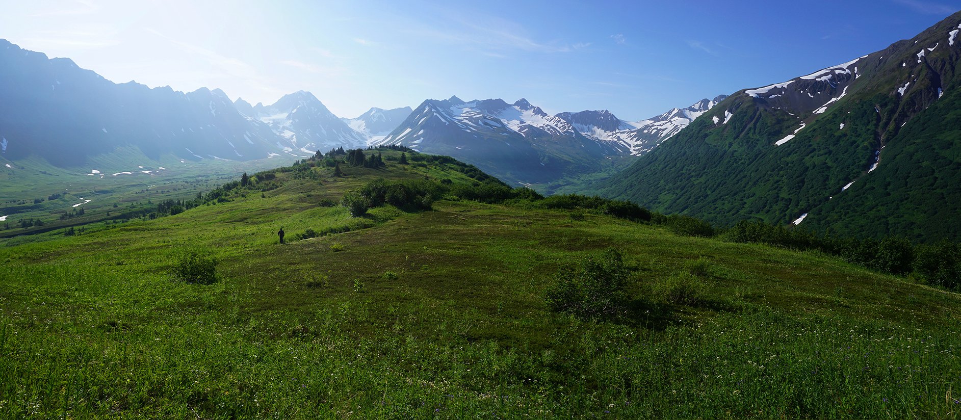
Starting down the far side, we soon encountered the first of other difficulties when we dropped down out of the hanging valley too soon. This dumped us into a steep slope of alders, which took some doing to push through before we reached the ridge face dropping down onto Whistlestop. Along that ridge we passed numerous small ponds and lakes dotting the tundra and spruce ridge top. Art even took some time to take a dip in one on that nearly 80-degree afternoon. After all, we though, we have time. We only have to climb down to the river.
But then we got into more difficulties by dropping down off that ridge too soon—which made for not only more intense bushwhacking down a very steep slope, but also trying to get around a number of cliffs. About a third of the way down the whistle of the 3 pm train drift up from below.
Overlooking Spencer Glacier
“Well, we can still make the 8 o’clock train,” I said. But the down-climbing continued to drag on. When we finally reached the shore of Placer River, we heard the 8 o’clock train whistle.
“Well I guess we’ll have to bivouac at the station,” I shrugged. At this point we only had to hike up river about 1 mile to cross the river over the railroad bridge.
As it turned out, this last mile proved the most difficult mile of all. About 100 years ago the builders of the railroad had cleared this entire river and erected a small village for the workers. Now all that second growth blocked our way—a low, tough tangle of stiff branches and curling trunks. The bushwhacking proved so frustrating that at one point I waded along the shore of a beaver pond just to avoid the brush.
Finally, sometime in the early hours of the gray night we reached the railroad bridge and followed the tracks the few hundred yards more back to Whistlestop. There we slept as well as we could in one of the vendors’ vans parked nearby with the mosquitoes buzzing in to find us through any crack available. All in all, not exactly how we expected the day to end. Then we waited through the hot, lazy day.
Finally, in the early afternoon we hopped onto the train that would take us to Grandview and then back to Portage. Scraped, sunburned, and tired, we could now relax, eat, and enjoy the scenery, making for a fine ending to a hike over a route that could use some tweaking.
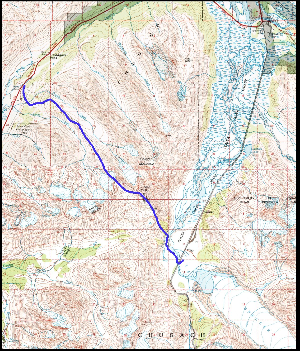
Map of Art Copolous and Shawn Lyons’ journey from Turnagain Pass to Spencer Glacier
Enjoy these articles? Sign up for our monthly newsletter to be sure to see them or follow us on Facebook or Instagram. Sign up below!
–Shawn Lyons has published five hiking guides to Southcentral Alaska. He has won the Iditashoe wilderness snowshoe race nine times, and the 100-mile Coldfoot Classic three times. For many years Shawn wrote a weekly hiking/climbing column for The Anchorage Daily News. Now he writes at shawnlyonsbooks.com. Shawn also teaches guitar, Music Appreciation, English Composition, and Literature at the University of Alaska in Anchorage.