By Shawn R. Lyons
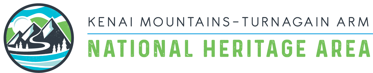
We only had to cross the 15-foot wide stream and climb up through 100 yards of brush to reach the open rock field leading up into the cirque that led into the heart of the mountain. But the deep and swift and the tangled and thick brush made for hard going. Even the rock field proved unstable. So we ended up clambering through the brush on the south side of the rocks to where we eventually reached the open tundra 500 feet above.
And so the day proceeded: nothing going really wrong, but little going quite right—which made, in the end, for quite an adventure. This adventure never took on epic proportions: we didn’t have to dodge any avalanches, get swept over waterfalls, or fall down any crevasses. We just spent far more time than we expected to climb Solars Mountain above Falls Creek on Kenai Peninsula.
On the south slope of Solars Mountain heading toward Kenai Lake
We worked through these inconveniences alone, seeing no other human all day. But though few venture high on the mountain now, many did in the past. Solars Mountain has the remains of two mines on it that date back to the first decades of the twentieth century. The road that now goes by the name Falls Creek Trail dates from those days. Ad though one miner still works to sift gold near the site of “The Betty,” a mine founded in 1905, the grunts and calls of laboring miners and the din of their rumbling equipment no longer echoes across the valley. Now there comes and goes only the occasional voices of hikers and climbers and the sputtering of a few ATVs.
But one look at the remains of equipment and the roads and trails the miners of yesteryear left in their passing. With a little care one can also see evidence of the buildings, mill and tramway in the brush at the upper end of the trail—all now silent in the encroaching brush. In looking at such artifacts one can only imagine what inconveniences these miners had to work through from day to day in cutting access to their claims, getting equipment up to the claims and then working the claims under all kinds of weather.
But though their inconveniences started from the highway, Cameron and I had little trouble hiking Ptarmigan Lake Trail and up Falls Creek Trail to its uppermost end. For that we could thank the miners who by 1911had expanded the original trail to “The Betty” into a wagon road. By that year the mine employed 22 people; had 9 buildings, including a five-stamp mill; and had built a 630-foot aerial tramway from the tunnel portal down to the uppermost end of the wagon road.
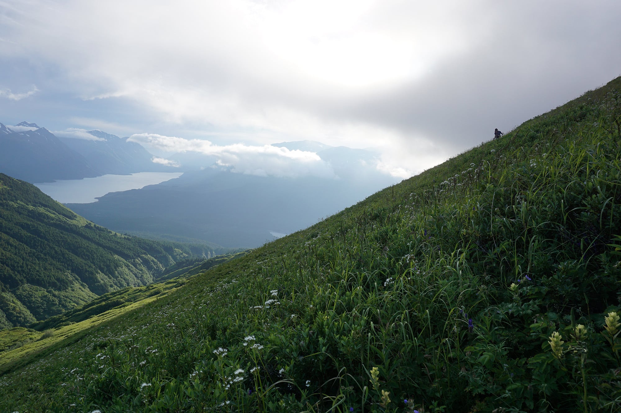
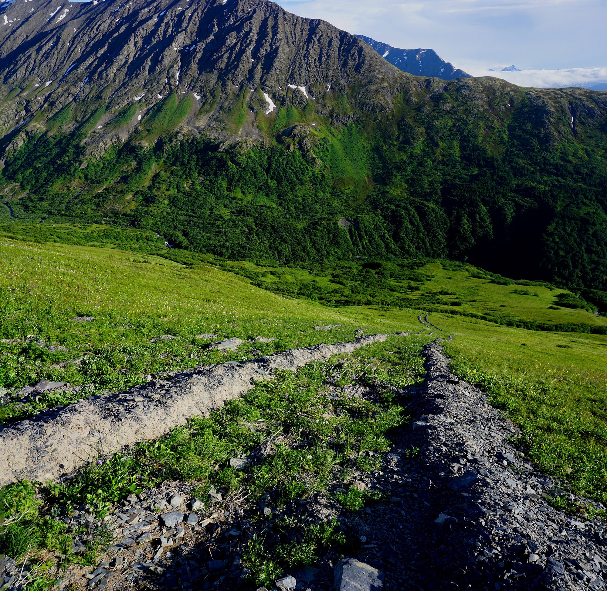
Looking up to the headwaters of Falls Creek
On a previous attempt to climb Solars Mountain from the top of Crown Point Mine Trail, where the second mining operation began work in 1924, we ran into a knife-edged ridge that defied any further progress with the right equipment. But that only made us want to try again. A later look at the map of the area and a couple of satellite photos hinted that the south col of the mountain may offer a more benign route. It seemed probable that we might even have only a long slog up a tundra slope to reach the summit—a possibility when climbing many mountains in Southcentral Alaska from the south.
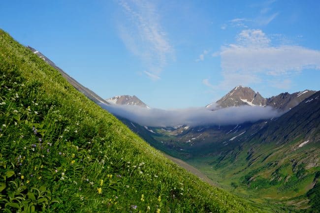
As we looked up at our planned route from the end of Falls Creek Trail we hoped to find such a tundra slope at the upper end of the rock pile. But upon reaching the upper end of the rocks, we only found more rocks and, surprisingly, a snowfield. Looking up the length of the snowfield to the saddle at its upper end, it dawned on us that Solars Mountain, unlike almost all other mountains on the Kenai, had snow couloirs cutting deep into all four of its flanks. We could also now see the rock saddle above the upper end of the snowfield, and the rocky ridge leading from there up to the summit ridge. As we looked we both knew we had a few inconveniences yet lying ahead before we reached the summit—if we could reach the summit.
It didn’t take long to kick steps up to the saddle. Looking over the far side, we looked into another couloir all the down to Grant Lake some 3,800 feet below. From this saddle we expected a long and laborious climb up a loose rock slope. But, surprisingly, the slope did not slip and slide from underneath us as we climbed to the summit ridge.
Once on the summit ridge we turned northwest to follow the edge of the crest for 200 yards of serious rock scrambling. This scrambling involved no 1,000-foot falls (unless we climbed too close to the ridge’s west side which dropped at a right-angle some 500 feet) but it could have resulted in any number of 20- to 100-foot falls if we didn’t move carefully.
Fifty yards after reaching one disappointing false summit we reached the true summit—which consisted of a 10-foot high boulder leaning out over a 6000-foot fall. Peering around the rock we could look down into the cirque that gouged out the western slope of the mountain—the same cirque to which Crown Point Mine Trail led. Off to our right (northwest) we could look down the ragged ridge we had tried to climb the previous year.
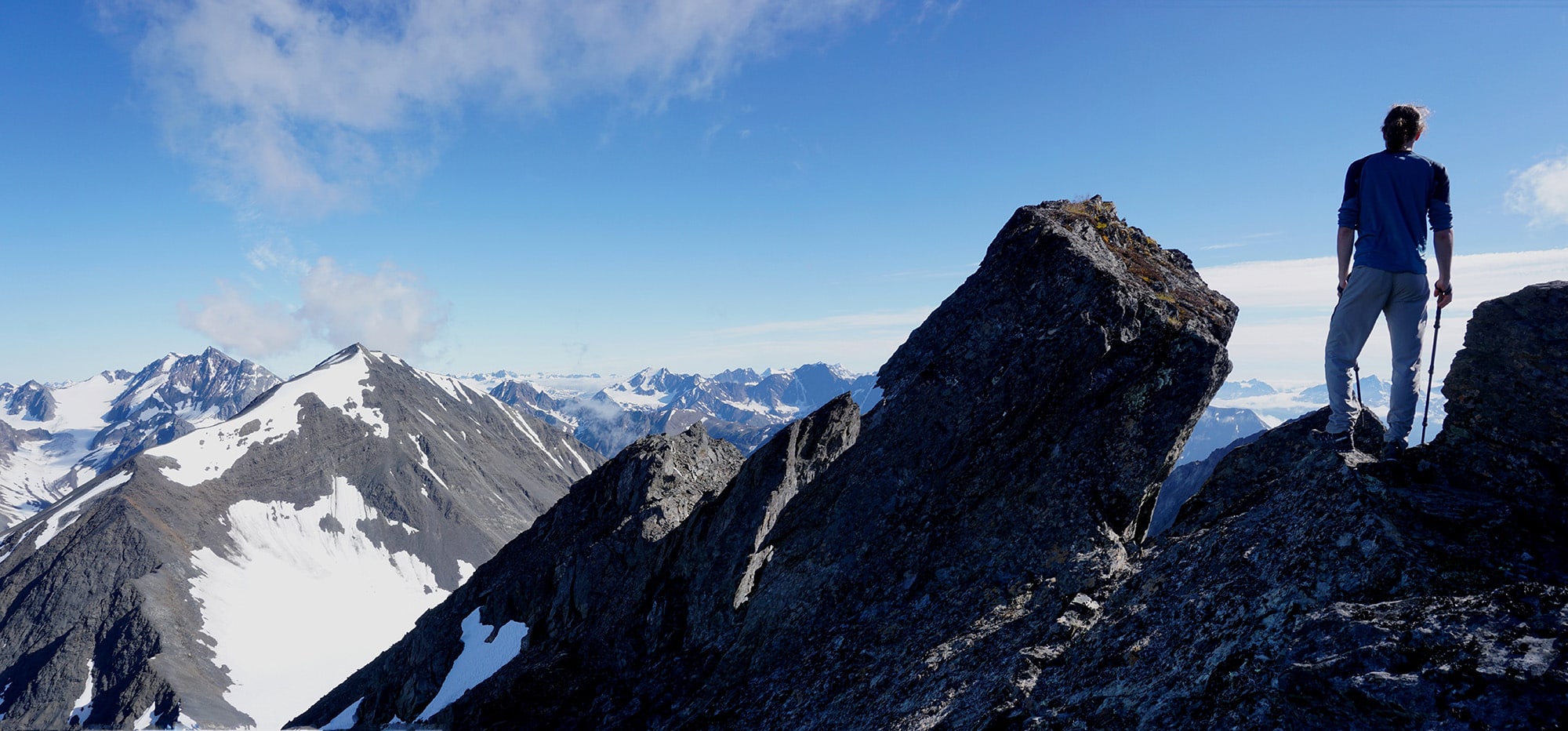
The summit of Solars Mountain
The descent involved no inconveniences, until we reached the lower end of the cirque. There we decided to take a different route out by cutting across the slope to the west and descend Crown Point Mine Trail. It made for some laborious side-hilling, but not without its rewards. On the way we passed a number of experimental pits dug by miners in the past. We also passed a very strange gouged out trench that started somewhere up near the crest of the south ridge and dropped down the fall line to the creek. So even and straight did it run that one might think it human made. But more likely some great rock had come loose and rolled down the mountain, gouging a deep path as it bounded down the slope.
Markings on the south slope of Solars Mountain
As it turned out, the decision to go out by way of Crown Point Mine trail proved much longer both in distance and time. The late midsummer night had long begun to dim the landscape as we walked out of the woods and onto the highway.
As we walked the few miles of highway in the late evening’s gloaming back to Ptarmigan Campground only a few cars passed us. We had the highway, surprisingly, almost all to ourselves in the late hour—just as we, unsurprisingly, had had the mountain to ourselves.
Enjoy these articles? Sign up for our monthly newsletter to be sure to see them or follow us on Facebook or Instagram. Sign up below!
–Shawn Lyons has published five hiking guides to Southcentral Alaska. He has won the Iditashoe wilderness snowshoe race nine times, and the 100-mile Coldfoot Classic three times. For many years Shawn wrote a weekly hiking/climbing column for The Anchorage Daily News.